The Gaia spacecraft, launched in 2013 by the European Space Agency (ESA), conducts a survey of the starry sky with orbiting telescopes in order to build the largest and most accurate three-dimensional map of our Galaxy in history.
A year ago, the long-awaited second release of the mission data was published, containing highly accurate measurements of positions, distances, and proper motions of more than a billion Milky Way stars. Based on this catalog, a lot of research has already begun in various fields of astronomy concerning the structure, origin and evolution of our stellar home. Since the launch, more than 1,700 scientific articles on his observations have been published.
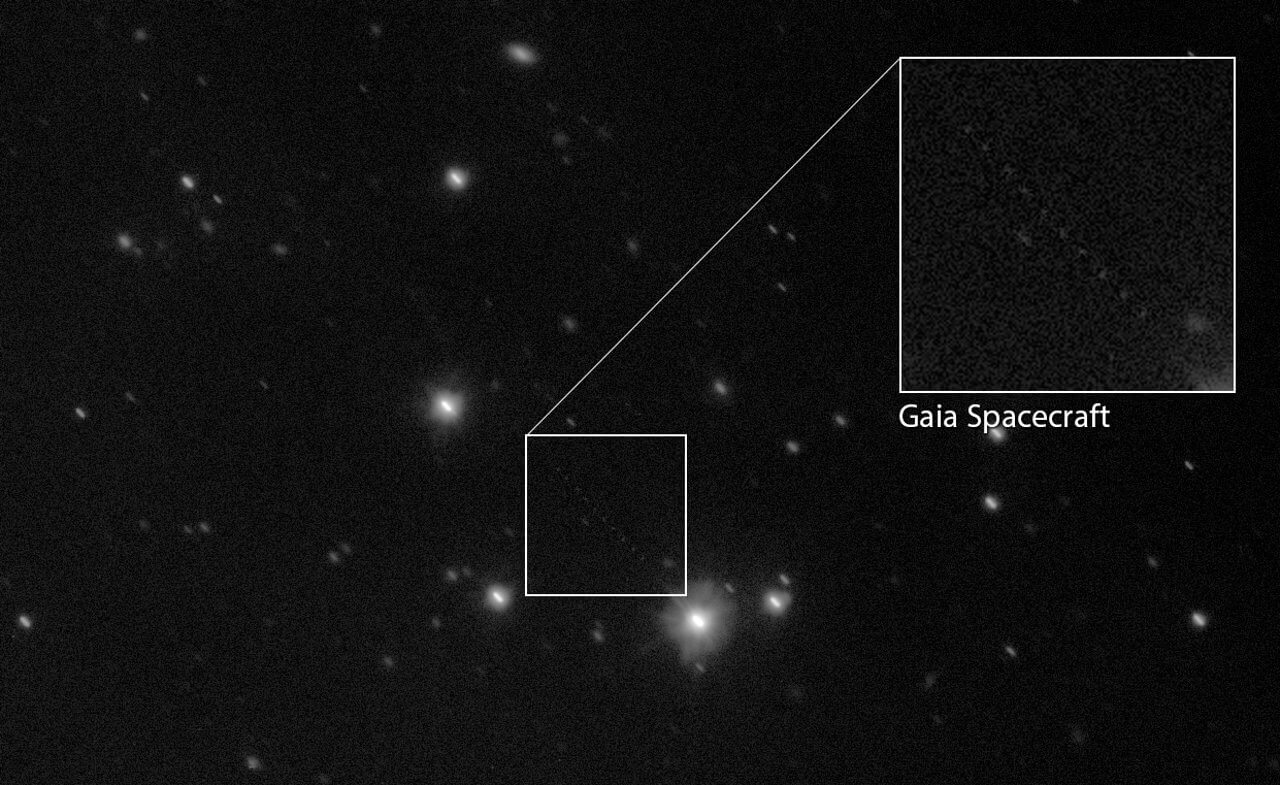
In order to achieve the accuracy needed to compose Gaia star charts, it is critical to accurately determine the position of the spacecraft relative to the Earth. Therefore, while the telescopes on board the apparatus scan the sky, collecting data for a census of the stellar population, astronomers regularly track the position of the satellite using a global network of optical telescopes, which also includes the VST Observatory in the European Southern Observatory (ESO) on Mount Paranal in Chile . VST is now the world’s largest optical telescope. He registers the position of Gaia among the stars every second night during the year.
Observations from the Gaia board require special procedures. The spacecraft is a “moving target” – it quickly shifts against the background of stars. Tracking his movement is a very difficult task!
-Monika Petr-Görzenz, who has been coordinating Gaia’s observations at ESO since 2013
Observations performed on the VST are used by ESA flight dynamics specialists, who monitor and correct the Gaia orbit and continuously refine its parameters. To reduce the observations of the spacecraft’s onboard telescopes, a complicated calibration process is required, during which measurements of the Gaia position, a barely perceptible spark moving in a star field, are transformed into the most accurate orbital parameters. In addition, each field star is identified using data from the “second release” of the satellite, which allows to calculate the position of the spacecraft with very high accuracy: up to 20 milliseconds of arc.
This process is technically very difficult: we use star measurements performed by the Gaia mission to calibrate the position of the ship itself and then, in turn, improve the accuracy of star position measurements.
-Timo Prusti, scientific coordinator of the Gaia project from the ESA
As a result of the application of complex and lengthy data processing procedures, astronomers have achieved the accuracy necessary for ground-based observations of the Gaia apparatus to be used to determine its orbit.
Information obtained during the implementation of the ground-based optical tracking campaign will be used to refine the orbit of the Gaia apparatus not only in future observations, but also for all data obtained previously from the Earth’s surface, which will improve the quality of future Gaia releases.
How Gaia spacecraft compile the most accurate map of the Milky Way
Click To Tweet
The post How Gaia spacecraft compile the most accurate map of the Milky Way appeared first on Upcosmos.com.